The Next Generation Digital-Twin Platform
Our team of experts follows a proven methodology to deliver a digital twin platform tailored to your needs. We survey areas using drones, process the data to create accurate 3D models, and provide tools for measurements, comparisons, and detailed analysis—all within one seamless platform.
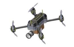
Drone Survey & 3D-Mapping
OQLO.AI is your go-to choice for top-notch drone survey and comprehensive drone inspection services. Based in Hyderabad, Telangana, we redefine how you visualize your projects and landscapes with cutting-edge drone technology. We utilize both RGB and LiDAR drones to capture high-resolution imagery and precise spatial data for comprehensive analysis and 3D modeling. Contact us for professional drone survey services.

Our Workflow
High-resolution orthomosaics and point clouds provide greater detail and clarity compared to traditional surveys
Data Capture

Data Processing & Data Analysis

Report Generation
Trusted & Proven Results
6+
CLIENTS ACTIVE
14+
TRUSTED BY COMPANY
5+
SURVEYS DONE
20+
SUCCESSFUL PROJECTS DONE
Core Strengths
Swift Turnaround
OQLO guarantees a 48-hour turnaround for most projects, empowering your business to act quickly and meet tight deadlines.
Cost Efficiency
Drone technology cuts survey time and labor, reducing costs by 80%—perfect for industries with tight budgets and deadlines.
Collaborations
Share your ideas and insights to improve collaboration and decision-making, fostering teamwork and creativity.
Precision Engineering
Achieve unparalleled accuracy with our state-of-the-art technology, ensuring that every detail is captured with meticulous attention.
Seamless Integration
Our platform integrates easily with your existing systems, ensuring a hassle-free experience without disrupting your workflows.
Resume Your Work in AutoCAD
Automated CAD file generation ensures immediate availability of data for project planning and execution.
AI-Driven Efficiency
Our AI platform accelerates processes, enhances accuracy, reduces errors, and improves decision-making with smart insights.
Multi-Format Reporting
We provide reports in multiple formats, including high-resolution imagery, comprehensive data tables, and 3D models.
Volume Measurement
You can quickly measure an object's volume using automated measurement tools for precise calculations.